


Dronecast - Weather & Fly Map
4.6306.00 Reviews
App Specs
- Version
- 2.1.472
- Updated On
- License
- Free
- Downloads
- 100,000+
- Developer
- Dronecast
- Categories
- Weather
- Platform
- Android
Screenshots

 Analysis by AppCompare
Hey there, drone enthusiasts! If you've ever found yourself staring at the sky, remote control in hand, wondering if today’s the day to fly, let me introduce you to an app that might just become your new best friend: Dronecast - Weather & Fly Map. I’ve been playing around with this app for a while now, and let me tell you, it’s like having a personal weather station and flight advisor rolled into one. Let’s dive into what makes this app tick.
First Impressions
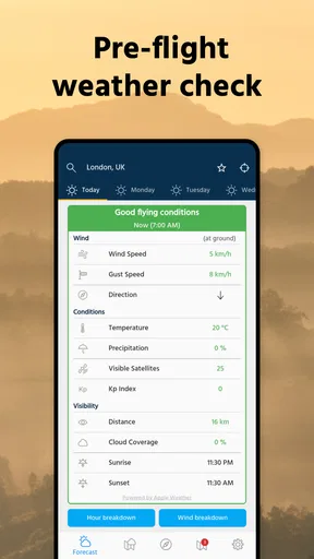
Okay, so the first thing I noticed when I downloaded Dronecast - Weather & Fly Map was the sleek and intuitive interface. It’s got that clean, modern look that makes you want to explore every feature without feeling overwhelmed. Opening the app, you’re immediately greeted with a user-friendly dashboard that highlights the current weather conditions at your location. It’s like the app just knows where you are and what you need, which is incredibly handy when you’re on the go.
Weather Insights
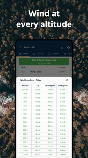
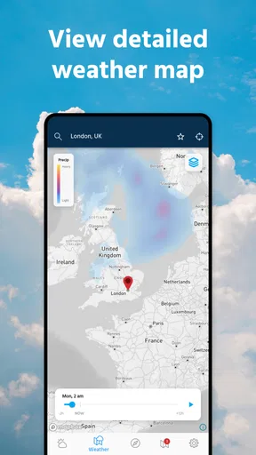
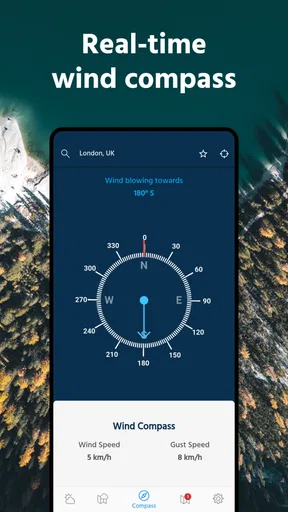
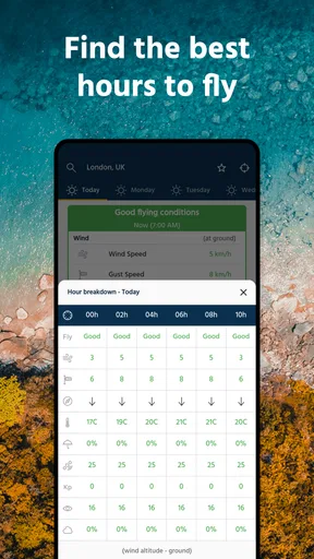
Let’s talk about weather, because, let’s face it, that’s what makes or breaks a drone flight. The app provides detailed weather forecasts tailored specifically for drone pilots. It goes beyond your standard weather app by including information like wind speed, direction, temperature, and humidity. Plus, there’s a handy visual map showing you real-time changes in weather conditions. This feature alone is a game-changer, especially if you’re planning a long flight or heading somewhere unfamiliar.
One of the coolest features is the risk assessment tool. It gives you a quick overview of potential flying risks based on current weather conditions. This means you can make informed decisions about whether to take off or wait it out. Trust me, it’s saved me from more than one potentially disastrous flight.
Planning Your Flight Path
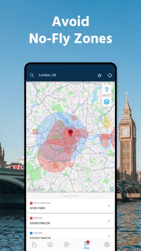
Beyond weather, Dronecast offers a comprehensive flight map. This isn’t just any map—it shows you no-fly zones, restricted airspaces, and other must-know areas for safe flying. You can plan your flight path with confidence, knowing you’re staying within legal and safe boundaries. The map is interactive, allowing you to zoom in and out and get a detailed view of the terrain and airspace regulations. It’s like having a co-pilot who’s got your back.
The app also allows you to save your favorite spots. So, if you stumble upon a perfect flying location, you can bookmark it for future flights. It’s a little feature, but it adds tons of convenience.
Community and Social Features
What’s flying without a little social interaction? Dronecast includes features that let you connect with other drone enthusiasts. You can share flight paths, tips, and even weather conditions in real-time. It’s a great way to learn from others and share your own experiences. Plus, the app has a built-in news feed that keeps you updated on the latest in the drone world, including new regulations and technology advancements.
Worth Reading Before You Choose

EA SPORTS FC Mobile 26 Is a Bigger Football Game, but It Takes Time

Flipboard Shows What News Apps Must Do Beyond the Feed

Switching to Android Auto Means Rethinking Your Driving Routine

Google Calendar Makes a Crowded Week Easier to Manage

Ludo King Makes the Most of the Minutes Between Plans

Baby Panda World Brings Quick Play to Modern Phones, but Its Game Library Feels Busy
Final Thoughts
Overall, Dronecast - Weather & Fly Map is a must-have for anyone serious about drone flying. Whether you’re a seasoned pilot or just starting out, this app provides all the tools you need to fly safely and smartly. It’s not just about avoiding bad weather; it’s about optimizing your flying experience every single time. The app is available for both Android and iOS, so no matter what device you’re using, you’re covered.
If you’re looking to elevate your drone game, give Dronecast a try. It’s like having a weather expert, a flight planner, and a community of fellow pilots all in your pocket. Happy flying!
Pros
- Intuitive user interface for easy navigation.
- Accurate real-time weather updates.
- Customizable alerts for flight conditions.
- Detailed maps with no-fly zones marked.
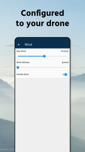
- Supports multiple drone models.
Cons
- Requires a stable internet connection.
- Battery drain can be significant.
- Limited offline functionality.
- Subscription needed for premium features.
- Some features are device-specific.
FAQs for Dronecast - Weather & Fly Map
What features does Dronecast - Weather & Fly Map offer?
Dronecast provides real-time weather updates, wind speed information, and no-fly zone alerts. It also includes detailed maps with user-friendly navigation, allowing drone pilots to plan flights efficiently. The app integrates local regulations and provides customized notifications to ensure safe and compliant flying.
Is Dronecast compatible with all types of drones?
Dronecast is compatible with most consumer drones that use GPS technology. It supports major brands like DJI, Parrot, and Autel. However, users should check specific compatibility with their drone model on the app's official website or app store listing before downloading.
Does Dronecast require an internet connection to function?
While Dronecast can store some offline data, a stable internet connection is necessary for real-time weather updates and accessing the latest no-fly zone information. Users are advised to connect to the internet before planning and executing their flight paths to ensure they have the latest data.
How accurate is the weather data provided by Dronecast?
Dronecast uses advanced meteorological data from reliable sources, providing accurate and up-to-date weather forecasts. The app offers detailed insights into wind conditions, temperature, and precipitation, which are crucial for safe drone operation. However, users should also rely on local reports for additional confirmation.
Is there a cost associated with using Dronecast?
Dronecast offers a free version with basic features, but users can upgrade to a premium version for more advanced tools and functionalities. The premium version includes enhanced weather details, additional map layers, and personalized alerts, providing a comprehensive tool for serious drone enthusiasts.


